Wednesday, September 2, 2015
 |
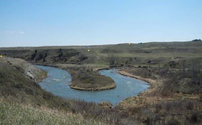
| Photo from Russ Thompson letter to council – possible location of power line crossing, north of Lundbreck |
 |
| Map of Lundbreck area, from Russ Thompson document submitted to council |
Regulatory power for transmission lines is reserved for the Alberta Utilities Commission (AUC), Council for the Municipal District of Pincher Creek No. 9 has no regulatory power but is regularly asked by its citizens to present their concerns to the provincial government.
“My background is in pipeline routing, so 30 years of routing experience on linear projects, albeit on pipelines, not power lines,” said Thompson. “I have looked at all the AltaLink routes, and I would like to present some alternates to you today.””In October, 2014 AltaLink had a different map, that showed 500Kv routes, but they really didn’t tell us they intend to build two lines on the site with Kv sections.”
“There is not just one, but but two sets of towers along those roads.””It’s definitely going to impact the viewscapes around here, having 2 500 Kv lines, versus a single line.”
“AltaLink’s shortest route is 38.27 kilometres. The next shortest is 38.4.”
“The one to Chapel Rock is 13.5 kilometres of 500 Kv, so that’s those two lines, whereas our option has 4.7 kilometers of 500 Kv which will equate to 9.4 kilometres of 500 Kv with the two lines there.
Thompson was also concerned about greenfield ratios. “How much of the new alignment is what’s called greenfield. That’s not parallel to existing infrastructure, such as pipeline right away, or utility corridor. Anytime you are not directly abutted to that, it’s called greenfield.”
“Greenfield is fairly important.” Thompson said the level of greenfield can escalate a project to another level of regulatory control.
“I was really alarmed when I saw these green fieldpercentages.” He said one route along the Pincher Creek Airport had 78% greenfield.
Water crossings were also a concern for Thompson. “It (Crowsnest River north of Lundbreck) is the most picturesque part of the river, and that’s exactly where AltaLink is proposing to cross.”
According to Thompson there are some issues around power lines crossing at the Oldman River Dam Provincial Recreation area. “AltaLink is trying to stay out of that, because there are some issues crossing that. In exchange for crossing a man-made feature for ease, they are proposing to cross a pristine river valley.”
Thompson explained the area was enhanced to replace destroyed habitat when the dam was established, and said it was home to wildlife and migratory birds, and frequented by kayakers and fly-fishers.
He demonstrated one proposed route with 4 crossings across Highway 3 between Pincher Station and Lundbreck. “This is going to look like an industrial park, if that route is adopted.”
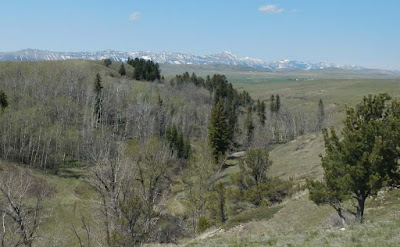
“These towers are 60 to 70 metres tall. That’s 6 to 10 times taller than any structures, any aluminum power line structures that are out there, so these things are going to be very intrusive. They are going to impact all of our views.”
 |
| A view near Lundbreck – Photo from Russ Thompson letter to council |
“You can lessen the impact everywhere you are, but that requires crossing the reservoir.”He offered alternate routs that he said ranged from 4.8 to 13 kilometres shorter than what Alta Link has proposed. “That being the case, it should be significantly less cost to the rate payers, and should have significantly less footprint in the MD.”
He said the routes he is proposing would have less visual impact as they do not run along the highways as much, two of his alternatives have no crossing of Highway 3, and they cross waterways. “Let’s cross it at the reservoir. It’s a man-made feature versus natural.”
Thompson said AltaLink’s proposed routes have anywhere from 37-146 residents within 800 metres, while his route proposals include some guidelines. “The green option has zero residences within 114 metres, and only 14 within 800 metres.””Another thing I want to point out to you is AltaLink just a few years ago built this line to Goose Lake which is just northeast of town, here. They’ve already developed a corridor to there, now they want to develop another corridor west of the Highway 6 junction that runs north-south. When is enough enough?”
Thompson said he presented his suggestions to AltaLink. “Their current position is they are not going to entertain any of the routes that I’ve suggested. I fully expected that they would say that. I think it is very apparent that AltaLink is not going to do anything, unless they’re forced to do it. The only people that are going to be able to force them to do it are the people who live in this area, and maybe the other people in this province that say enough’s enough.”